Innovación | Proyectos por ámbitos
Proyectos por ámbitos
Miembros del IEEC llevan a cabo proyectos de investigación y desarrollo aplicados en gran variedad de ámbitos: investigación científico-tecnológica, observación de la Tierra, navegación, seguridad espacial, telecomunicaciones, tecnologías de exploración planetaria y segmento terrestre, entre otros.
El IEEC, en algunos casos a través de sus Unidades de Investigación, cubre una gran variedad de aplicaciones con los proyectos de investigación y desarrollo que lleva a cabo: comunicaciones con nanosatélites, ciencias atmosféricas y astronómicas, infraestructuras científicas, desarrollos tecnológicos para misiones espaciales actuales y futuras, sistemas de posicionamiento y aumentación por satélite y su vinculación con tecnología 5G, algoritmos de compresión de datos, y planificadores de telescopios terrestres para misiones espaciales, entre otras.
A continuación destacamos los más relevantes y recientes, distribuidos en siete áreas temáticas, aunque existen interrelaciones entre sí.
Programas de investigación científico-tecnológicos
Los programas de investigación que abarcan los componentes científico y tecnológico son un pilar fundamental entre los proyectos desarrollados desde el IEEC.

En particular, estos programas son muy relevantes en el marco de desarrollos con un componente de innovación significativo y que son de alto interés para futuras misiones.
Destacan recientemente los proyectos de la ESA, llamados LETS y LIRA, vinculados a la contribución a la misión LISA en el área de astronomía de ondas gravitacionales, con el desarrollo de un subsistema de control de temperatura de alta precisión, que permiten el análisis y calibración de sensores de temperatura, incluidos sensores ópticos.
Observación de la Tierra
La Observación de la Tierra desde el espacio es un elemento clave para las ciencias relacionadas con la Tierra. Las aplicaciones derivadas de la Observación de la Tierra son fundamentales para comprender y mitigar algunos de los grandes retos actuales: el cambio climático, la crisis de recursos naturales, emergencias y daños medioambientales o la pérdida de la biodiversidad.

En este contexto, el IEEC es un centro líder en teledetección y uso de señales de geoposicionamiento para aplicaciones de Observación de la Tierra, desde la invención de técnicas de medida, prototipos de algoritmos y de instrumentación, técnicas de calibración, verificación y validación, así como preparación y participación en misiones espaciales relacionadas.
Entre las principales áreas de especialización del IEEC destaca el uso de los Sistemas Globales de Navegación por Satélite (GNSS) en ciencias atmosféricas, la reflectometría basada en señales de oportunidad GNSS (GNSS-R), las radio ocultaciones GNSS (GNSS-RO), las tecnologías hiperespectrales avanzadas y su aplicación en pequeños satélites, la fusión de datos para la generación de productos de Observación de la Tierra y la mejora de las infraestructuras espaciales ya existentes (en particular, del programa Copernicus).

Navegación
En diversos grupos del IEEC se pone de manifiesto la amplia experiencia en Posicionamiento, Navegación y Sincronización (Positioning, Navigation and Timing, PNT) en múltiples ámbitos como la Observación de la Tierra, las Telecomunicaciones y la Meteorología Espacial, y en aplicaciones terrestres que requieren geoposicionamiento.
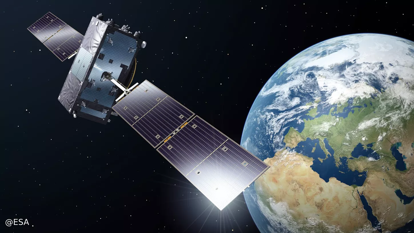
Se pone énfasis también en la mejora de las infraestructuras espaciales existentes, EGNOS y Galileo (EGNSS), y en sus evoluciones futuras y servicios asociados, así como en el desarrollo de nuevos conceptos en LEO-PNT, complementarios al GNSS, basados en transmisión de señales de navegación desde órbitas bajas. También cabe destacar el posicionamiento basado en púlsares para permitir en el futuro la navegación interplanetaria.
Ejemplos relevantes incluyen, entre otros, el diseño, el desarrollo y la prueba de algoritmos para futuros nuevos señales EGNSS y LEO-PNT, nuevos receptores GNSS de bajo consumo para aplicaciones de Internet de las Cosas, mitigación de interferencias y autenticación de mensajes de navegación, aspectos relevantes en ciberseguridad y pruebas de concepto del Galileo Commercial Authentication Service (CAS).
Seguridad espacial

Para estos efectos, se impulsan programas de vigilancia y seguimiento espacial (SST) y meteorología espacial (SWE) del programa de seguridad espacial (S2P) para la supervisión y el análisis de los factores relacionados, como son la actividad del Sol, la magnetosfera, la ionosfera y los cambios en las trayectorias de los objetos espaciales.
El Observatorio del Montsec (OdM) contribuye activamente desde hace años en el programa SST de la Unión Europea (EUSST) en el seguimiento de satélites. También existe una participación significativa en el programa S2P a través de los proyectos SWESNET y SWEMED.

Telecomunicaciones
Más allá de promover las telecomunicaciones como una de las tres temáticas de la Estrategia NewSpace de Catalunya, el IEEC participa en proyectos vinculados al desarrollo de un telepuerto de comunicaciones satelitales en el Observatori del Montsec (OdM), en el diseño de señales y modulaciones por EGNSS, así como en proyectos vinculados a aplicaciones que requieran de comunicaciones 5G y el uso del Internet de las Cosas (IdC).

Ejemplos de lo anterior incluyen la utilización de la estación de comunicaciones satelitales del NanoSatLab de la UPC, con antenas en las bandas VHF/UHF y S, para la comunicación con el satélite Enxaneta, y los trámites regulatorios de radiofrecuencia correspondientes.
En particular, el IEEC es responsable de la explotación de esta estación y se ha inscrito en el registro de operadores de redes y de servicios de comunicaciones electrónicas de la CNMC. También destacan proyectos en compresión de datos para fomentar el uso eficiente de los radioenlaces satelitales y un proyecto de innovación vinculado a la Formación Profesional que promueve el despliegue de laboratorios de comunicaciones 5G, satelitales y el IdC para aplicaciones en seguridad laboral.
Tecnologías de exploración planetaria
El IEEC es un centro puntero en la construcción de instrumentación y sensórica para la exploración espacial.
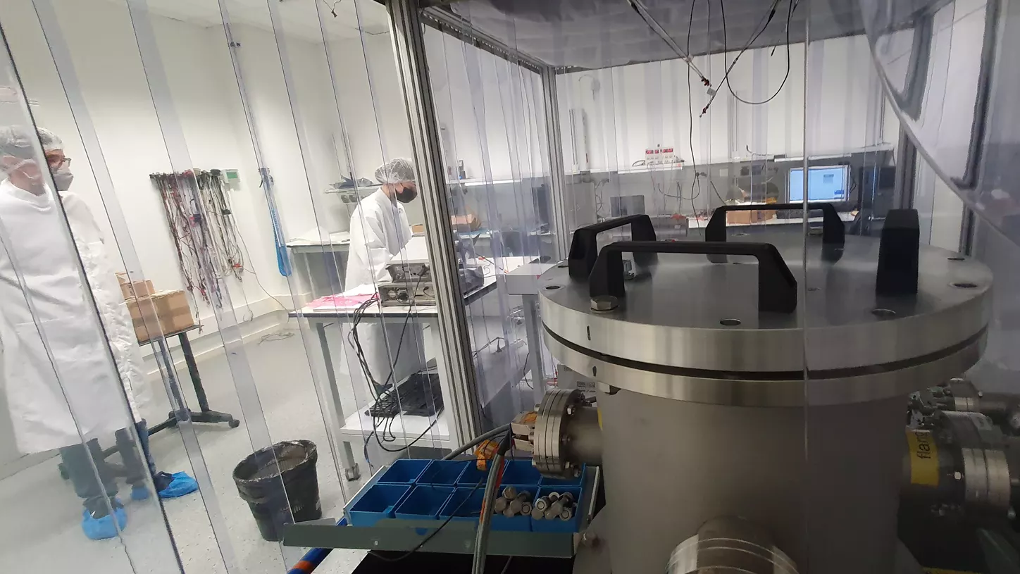
En particular, para misiones en la Luna y en Marte y para el estudio científico de exoplanetas. También participa en distintas redes europeas que definen la hoja de ruta en áreas de investigación teórica y experimental.
Fruto del proyecto MELISA, impulsado desde el IEEC, se ha diseñado y desarrollado un magnetómetro miniaturizado, de muy bajo ruido, en el rango ultrabajo de frecuencias, que implementa la modulación del campo magnético mediante resonadores microelectromecánicos (MEMS). Otro caso de colaboración europea es el proyecto MiniPINS, cuyo objetivo es desarrollar y prototipar paquetes de sensores de superficie miniaturizados para Marte y la Luna.

Segmento terrestre
En el marco del estudio del cosmos y la Tierra, el IEEC es un agente activo en la construcción de instrumentación astronómica y terrestre
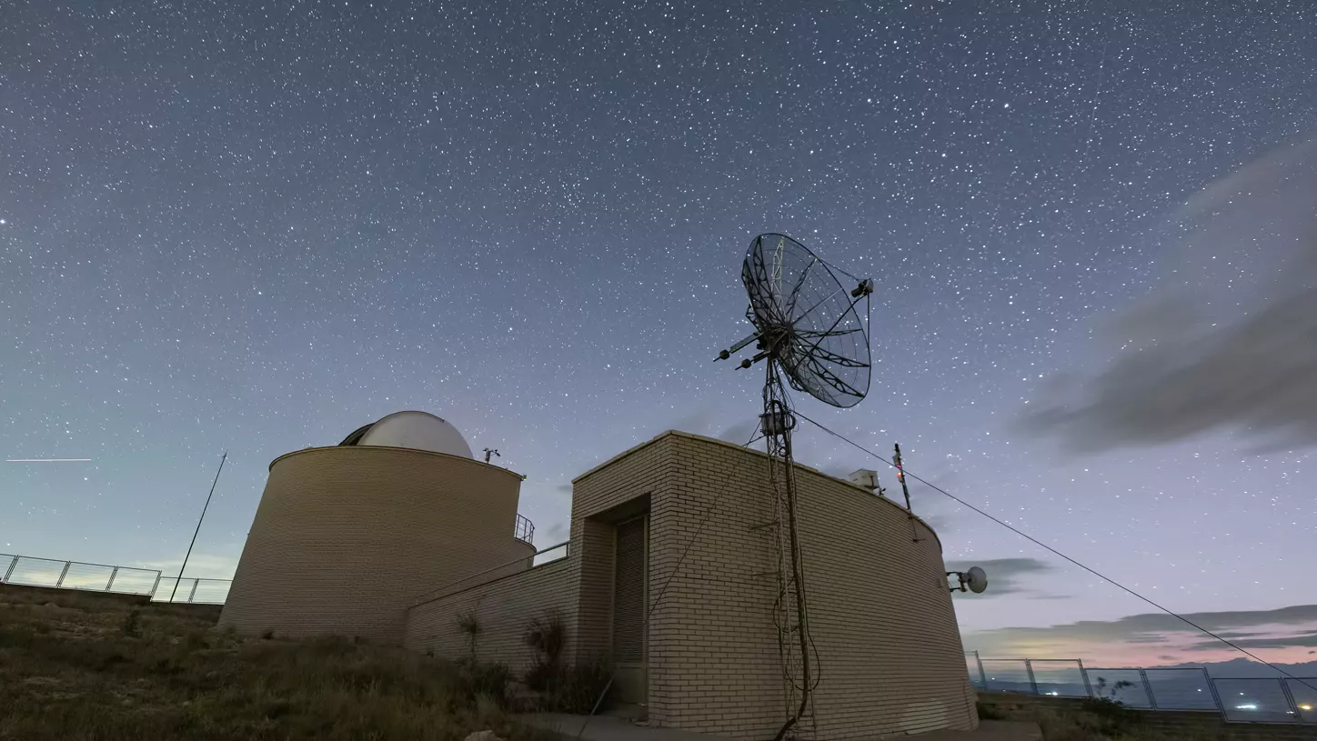
Asume responsabilidades de alto nivel en la implementación, gestión operativa y en el procesado de datos a nivel del segmento terrestre.
Todo esto se refleja con el fomento de un telepuerto de comunicaciones en el Montsec, del que destaca la estación terrestre en banda S del Observatorio del Montsec, el desarrollo y la adaptación del software STARS para el telescopio COLIBRI en México, y la colaboración en investigación y desarrollo para el observatorio Cherenkov Telescope Array (CTAO) en el desierto de Atacama, situado en el noreste de Chile.
KTT Contract:
Optical Fiber Micro-Kelvin Temperature Sensor Network for Sensitive Optical Payloads (LIRA)
The main objective of the current ITT is the design of an optical fiber temperature subsystem prototype (TRL4) for the future gravitational wave observatory LISA. The design of the current proposal builds upon the experience of the IEEC-led team in the design of the LISA Pathfinder temperature diagnostic subsystem, the analysis of the results obtained during the LISA Pathfinder operations phase with the aforementioned subsystem and, finally, the expertise acquired with the LETS (LISA Enhanced Temperature Subsystem) contract (4000127051/19/NL/BW). The study is coordinated by the IEEC and carried out together with INESC TEC, with responsibility for the design and implementation of the optical fiber sensor head, requiring a dedicated design.
Coordinator: Miquel Nofrarias (IEEC-CSIC)
Funding Institution: European Space Agency (ESA; Contract No. 4000135481/21/NL/AR)
Partners: IEEC, INESC TEC (Portugal)
Duration: 09/2021-03/2023
KTT Contract:
Enhancement of temperature measurement for LISA (LETS)
ESA contract to develop a Technology Development Activity to achieve a system for an ‘Enhanced temperature measurement for LISA’ and with the goal to design a prototype temperature subsystem (TRL4) for the LISA space mission increasing one order of magnitude the performance (1 uK/√Hz) down to 1mHz. The leadership for the specific tasks is allocated to the three different partners: design of front-end electronics (IEEC), design of ultra-stable test bench (DLR), integration, verification and testing (IEEC), roadmap to TRL6 (SENER).
Coordinator: Miquel Nofrarias
Funding Institution: European Space Agency (ESA; Contract No. 4000127051/19/NL/BW)
Partners: DLR, SENER
Duration: 01/09/2019 – 30/07/2022
KTT Contract:
2nd Scout Mission HydroGNSS
The IEEC, as partner in the HydroGNSS mission proposal to the ESA’s Scout Programme, is subcontracted to Surrey Satellite Technologies Ltd (SSTL, UK) to contribute to the implementation of the mission, planned for launch in 2024. The IEEC supports SSTL in developing parts of the End-to-end simulator (E2ES), a package of software to process ultra-low level data (intermediate frequency samples of unprocessed signals) once downloaded into ground, and the official ground based algorithms to generate level-2 products related to inundation of the surface (flooding, wetlands).
Coordinator: Estel Cardellach (IEEC-CSIC)
Funding Institution: European Space Agency (ESA)
Partners: SSTL UK, La Sapienza University (Italy), Finnish Meteorological Institute
(FMI, Finland); National Oceanographic Centre (NOC, UK), Tor Vergata University
(Italy), IFAC-CNR (Italy), University of Nottingham (UK)
Duration: 2021-2026
KTT Contract:
Sentinel-3 CD – Topography and GNSS Reflectometry for data processing over sea ice
The objective of this activity is to advance: a) in the theory and processing of ideal grazing GNSS reflectometry (specular surface and no atmosphere), b) in the modelling of surface reflection over lakes, open ocean and sea ice, c) in the modelling of ionospheric and tropospheric effects and their correction, and d) in the acquisition of further co-located data sets with Sentinel- 3 over instrumented lakes using all acquired raw data sets (those in Table 1 plus the 3 new acquisitions) and supporting ancillary data from other sources (such as Sentinel-3 altimetry and surface roughness, meteorological ground-based stations, weather balloons, TEC maps from IGS, information on physical conditions from ECMWF, SMOS-Cryosat derived sea ice thickness, SAR satellite images, etc.). The activity will cover all objectives, but with a focus on inland water bodies and sea-ice altimetry. Advancing and consolidating this alternative technique could provide means to validate Sentinel-3 acquisition over lakes (and other surfaces) where in situ measurements are not available.
Coordinator: Weiqiang Li (IEEC-CSIC)
Funding Institution: European Space Agency (ESA)
Duration: 12/2021-12/2022
KTT Contract:
MAXSS – Marine Atmosphere eXtreme Satellite Synergy
The primary objective of the ESA Marine Atmosphere eXtreme Satellite Synergy (MAXSS) project is to provide guidance and innovative methodologies to maximise the synergetic use of available Earth Observation data (satellite, in situ) to improve understanding about the multi-scale dynamic characteristics of extreme air-sea interaction. In MAXSS, three developments are conducted: (1) The development of a Multi-Mission Wind Product, (2) The development of an extreme Winds (severe storm, cyclone) atlas, and (3) The development of added-value products to analyse storms.
Coordinator: Estel Cardellach (IEEC-CSIC)
Funding Institution: European Space Agency (ESA)
Partners: SSTL UK, La Sapienza University (Italy), Finnish Meteorological Institute
(FMI, Finland); National Oceanographic Centre (NOC, UK), Tor Vergata University
(Italy), IFAC-CNR (Italy), University of Nottingham (UK)
Duration: 01/2021-01/2023
KTT Contract:
PITHIA-NRF – Plasmasphere Ionosphere Thermosphere Integrated Research Environment and Access services: a Network of Research Facilities
PITHIA-NRF (Plasmasphere Ionosphere Thermosphere Integrated Research Environment and Access services: a Network of Research Facilities) pretén construir una PITHIA-NRF aims to build a European distributed network that integrates observing facilities, data processing tools and prediction models dedicated to ionosphere, thermosphere and plasmasphere research. For the first time, PITHIA-NRF integrates on a European scale, and opens up to all European researchers, key national and regional research infrastructures, such as EISCAT, LOFAR, ionosondes and digisondes, GNSS receivers, Doppler sounding systems, riometers, and VLF receivers, ensuring optimal use and joint development. PITHIA-NRF is designed to provide organised access to experimental facilities, FAIR data, standardised data products, training and innovation services. Furthermore, PITHIA-NRF facilitates research advances in the field of upper atmosphere and near-Earth space, through the integration of data collections from satellite missions (such as Cluster, DEMETER, Swarm and CHAMP) and results from key prediction models, which can be accessed by scientific users for joint exploitation with the data collected from the research infrastructures of the network. IEEC-UPC group operates the node of thermosphere-ionosphere coupling models based on ground and space-based GNSS data providing hands-on access to research users. In addition to this, the group strongly contributes to the registration of data and models in PITHIA-NRF e-science centre, and participates in training, dissemination and innovation activities.
Coordinator: Manuel Hernández-Pajares (IEEC-UPC)
Funding Institution: European Commission (EC; H2020 Grant Agreement no. 101007599;
H2020-INFRAIA-2018-2020)
Duration: 04/2021-03/2025
KTT Contract:
BEEPS-IOM, Biomass end-to-end performance simulator – Ionospheric Module
ESA’s BIOMASS Earth Explorer mission aims at providing global aboveground forest biomass. Its payload is a UHF synthetic aperture radar. At UHF ionospheric effects, notably the group delay and phase advance, the Faraday rotation, and the intensity and phase scintillations (or rapid fluctuations) are significant and have to be properly modelled to be compensated, to understand the limitations of the proposed technique, and to select the optimum observation conditions. In this project the ionospheric module of the BIOMASS end-to-end performance simulator (BEEPS-IOM) is implemented. IEEC is in charge for the algorithm development and prototyping in Matlab, and RDA (CH) to convert them into C++, complying with all ESA quality standards.
Coordinator: Adriano Camps
Funding Institution: European Space Agency (ESA)
Partners: RDA (CH)
Duration: 30/1/2020-30/12/2022
KTT Contract:
SIMIONO, Ionosphere Impact and Corrections for Low Frequency Radars
The objective of this project is to consolidate the understanding, assessment and correction of ionospheric effects on space-borne low-frequency radar observations, including several modes of P & L-bands SAR (monostatic, bistatic, polarimetric, interferometric), as well as VHF/UHF radar sounders, and GNSS-Reflectometers for scatterometry and altimetry. A correct and fine representation of the ionosphere layers (models, data), considering both the mean values and the inhomogeneities causing spatial and temporal fluctuations of the electron density at different scales are considered, and an API is implementing these models for use in future ESA end-to-end performance simulators. The project is coordinated by ONERA (FR), who is in charge of the algorithm prototyping of SAR sensors. IEEC is in charge of the algorithm prototyping of low-frequency radar sounders and GNSS-R instruments, and RDA (CH) is in charge of converting these algorithms into C++, complying with all ESA quality standards.
Coordinator: Adriano Camps
Funding Institution: European Space Agency (ESA)
Partners: ONERA (Fr), RDA (CH)
Duration: 30/1/2020-30/12/2022
KTT Contract:
OSIP Open Channel Early Technology Development Activities Evaluation Session 2020-05 – Widelane Grazing Angle Carrier Phase Altimetry with GNSS Reflected Signals: exploring beyond the PRETTY mission
IEEC leads an experimental campaign, funded under the ESA’s Open Space Innovation Platform (OSIP), to understand the performance of GNSS sea surface altimetry using carrier phase delay observations at grazing angles of observation at two frequencies. This new technique can be applied when the scattering off the sea waves presents a strong coherent component, i.e., when the surface is effectively smooth with respect to the electromagnetic wavelength and geometry. The chances of coherent scattering increase at grazing angles of observation. The smart use of the dual frequency system is also investigated. The experiment uses IEEC developed hardware installed on top of Puig Major (Serra de Tramuntana, Mallorca) at over 1400 m altitude close to the sea. An oceanographic buoy located at the observational area provides in situ wind and waves information.
Coordinator: Estel Cardellach
Funding Institution: European Space Agency (ESA; Contract No. 4000133252/20/NL/GLC)
Partners: IEEC, IMEDEA-CSIC, SOCIB, DLR
Duration: 26/11/2020-31/1/2022
KTT Contract:
Analysis of Water Relations in the Soil-Plant Continuum Using Microwave-Lidar Synergy
The project exploits L-band passive and active microwave missions, as well as Lidar vegetation height measurements, in order to disentangle the water component from the signal of the passive microwave attenuation variable, the vegetation optical depth (VOD). The VOD contains information on biomass, vegetation structure, and vegetation water content. In this project, VOD-derived vegetation moisture maps are produced and are applied as a keystone variable to model the water flux in the soil-plant-atmosphere continuum (SPAC). This new, multi-sensor approach provides more detailed models of the SPAC, which is an essential component in the water and carbon cycles. Therefore, the project provides future models on carbon uptake and climate scenarios, is used to monitor vegetation hydric stress, and provides a more accurate understanding of a key ecophysiological process.
Coordinator: David Chaparro
Funding Institution: Fundació “la Caixa”
Partners: MIT (USA), DLR (Germany), Universitat de València, Université Catholique de Louvain (Belgium)
Duration: 1/1/2020 – 31/8/2022
KTT Contract:
Forecasting Space Weather Impacts on navigation systems in the Arctic – Greenland Area (FORSWAR)
Prototype of a new advanced space weather forecast model for Positioning, Navigation and Timing (PNT) satellite-based users in the Greenland area. New techniques for space weather forecasting (in particular ionospheric scintillation forecasting) are being developed and their advantage over existing models will be analysed. The new model aims to provide a readable map over Greenland that indicates weak, moderate and severe disturbances to PNT applications for general users.
Coordinator: Manuel Hernández-Pajares
Funding Institution: European Space Agency (ESA-ESTEC; contract no. 4000131555/20/NL/AS)
Partners: University of Oslo, DLR
Duration: 10/09/2020-10/12/2021
KTT Contract:
SWESNET – Space Weather Service Network
The Space Weather Service Network in the ESA Space Safety programme consists of five expert service centres that provide crucial information on the space weather situation. The network provides services in the following domains: Solar Weather, Heliospheric Weather, Space Radiation, Ionospheric Weather and Geomagnetic Conditions. The IEEC-UPC group participates as part of the Ionospheric Weather expert service centre, contributing with real-time services for the GNSS-based solar flares’ detection and monitorisation based on the world-wide distributed network of permanent GNSS receivers. Alerts are also triggered in case of solar flares impacting the Earth’s ionosphere.
Coordinator: Manuel Hernández-Pajares (IEEC-UPC)
Funding Institution: European Space Agency (ESA)
Partners: BIRA-IASB (Belgium); 42 Europe-wide partners.
Duration: 02/2021-02/2023
KTT Contract:
Space Weather User Needs for the Mediterranean Region (SWEMED)
The project aims to identify how the SSA SWE segment customer requirements baseline needs to be enhanced and tailored to best meet the needs of end users operating in the Mediterranean region. To achieve this, a user consultation exercise has been performed including workshops in five countries of the Mediterranean region: France, Greece, Italy, Portugal, and Spain. The targeted sectors include communication and navigation, offshore resource exploration/exploitation, power system operation, pipeline operation, railway operation, aviation, shipping, logistics, space surveillance and insurance.
Coordinator: Manuel Hernández-Pajares
Funding institution: European Space Agency (ESA-ESOC, SSA P3-SWE-XXIII.1)
Partners: Universidad de Alcalá, GMV, Deimos, NKUA
Duration: 06/2019-05/2021
KTT Contract:
WhiteDwarf
This project dealt with the maintenance of the ESA’s Whitedwarf suite of CCSDS data compressors and decompressors, with the objective of ensuring high quality implementations of compression standards CCSDS 121.0-B-3, CCSDS 122.0-B-2, and CCSDS 123.0-B-2. The ESA’s existing implementations required extensive modifications to either correct known defects, or to be upgraded to the latest versions of the standards. Hence the project included extensive rewrites of the aforementioned software suite, including a full implementation of a CCSDS 122.0-B-2 decoder created from scratch, as well as a significant testing and validation campaign so that they could be used as reference models in other projects.
Coordinator: Joan Serra-Sagristà, Ian Blanes (IEEC-UAB)
Funding Institution: European Space Agency (ESA)
Duration: 01/2021-12/2021
IEEC Contract:
MELISA – MEMS miniaturized low-noise magnetic field sensor for LISA
The objective of MELISA (MEMS miniaturized low-noise magnetic field sensor for LISA) is the design and fabrication of a prototype (TRL4) magnetic field sensor implementing magnetic field modulation by means of micromechanical resonators. The prototype will show the feasibility of applying this noise-reduction technique to fulfil the stringent requirements of the LISA mission. The proposal plans to explore the exploitation of the resulting high performance sensor for its application in surface planetary exploration missions and Cubesats in LEO or other planetary bodies’ orbits.
Coordinator: Manuel Domínguez Pumar (IEEC-UPC)
Funding Institution: CERCA & IEEC
IEEC units: IEEC-UPC, IEEC-CSIC, IEEC-UB
Duration: 04/2021-05/2022
KTT Contract:
MiniPINS – Miniature Planetary In-situ Sensors (CCN extension)
MiniPINS is an ESA study to develop and prototype miniaturised surface sensor packages (SSPs) for Mars and the Moon. The study aims at miniaturising the scientific sensors and subsystems, as well as identifying and utilising commonalities of the packages, making it possible to optimise the design, cut costs and reduce the development time. The group has participated in the analysis and selection process of the different sensor systems in view of the multiple science requirements and mission constraints. The group has also participated in the prototyping of some of the sensor systems that have been selected for demonstration in the contract. Specific effort is devoted to the miniaturisation of the different electronic and sensor systems. SSPs are capable of working on the surface of Mars or the Moon and they can produce high quality science data with state of art instrumentation. In particular, Mars SSP MINS is a penetrator with approx. 25 kg mass, piggy- backed by another Mars mission spacecraft to the Martian orbit and deployed from there. The science programme is focused on the study of Mars’ atmosphere, seismology, magnetic field and chemistry. The Moon SSP will be a miniature 5 kg station deployed on the Moon’s surface by a rover. Both Mars and Moon SSPs will be miniaturised, light and robust, and still capable of surviving high G loads and extreme thermal environments. The output of this contract will enable the ESA to prepare the technological programmes required for these ambitious planetary missions.
Coordinator: Manuel Domínguez Pumar (IEEC-UPC)
Funding Institution: European Space Agency (ESA)
Partners: FMI, INTA, SCIS-INTA, AVS, UPC, IMSE, IMDEA, Talvioja Consulting Ltd.
Duration: 04/2021-10/2021
Collaboration Agreement for the exploitation of the S-band Ground Station at Montsec Observatory
Collaboration Agreement between the UPC and the IEEC for the creation of the scientific infrastructure that consists of the S-band Ground Station for LEO-orbit satellite communications, located at Montsec Observatory (OdM). The agreement establishes the conditions for its installation, exploitation and operations.
Entities: Universitat Politècnica de Catalunya·BarcelonaTech & IEEC
Responsibility: Ignasi Ribas, Adriano Camps, Josep Colomé
Duration: 01/2021-01/2031
KTT Contract:
STARS scheduling software for the COLIBRI Telescope
The STARS (Scheduling Technologies for Autonomous Robotic Systems) software framework developed by the IEEC for telescope time scheduling purposes was adapted and delivered to the Laboratoire d’Astrophysique de Marseille (LAM) for its specific use at the COLIBRI telescope. The framework is complemented with two graphical interfaces: the Management for Users in the Robotic Observatory Control System (MUR) for proposal management (or planning) purposes; and the Analysis Tool for Planning (ATP) that is used for an expert performance analysis of the obtained schedules. COLIBRI telescope is located in Mexico and is devoted to carry out automatic follow-up observations of the SVOM (Space based multi-band Variable Object Monitor) satellite, a French and Chinese mission for GRB detection to be launched by the end of 2021.
Coordinator: Francesc Vilardell & Josep Colomé
Funding Institution: Centre National de la Recherche Scientifique – Laboratoire d’Astrophysique de Marseille (CNRS-LAM, France)
Duration: 05/2020 – 05/2021
KTT Contract:
IAC tender CTA Lot 3
Production, integration and validation of mechanical elements, electronics and programming for the construction of the cameras for the Large-Size Telescopes LST-2, LST-3 and LST-4 of the Cherenkov Telescope Array observatory in the Northern site (ORM, Observatorio del Roque de los Muchachos). Contract devoted to the Camera Control Software that allows the data acquisition of the Cherenkov radiation with the camera detector and the calibration light, and uses weather sensors to provide a high-logic behaviour ensuring the correct instrument operation.
Coordinator: Josep Colomé
Funding Institution: Instituto de Astrofísica de Canarias (IAC; LIC-19-008-Lote3)
Duration: 8/6/2020-23/12/2022
KTT Contract:
Collaboration on calibration and environmental monitoring for preparing the implementation of the Cherenkov Telescope Array Observatory
The purpose of the contract is to establish and carry out a Research and Development Collaboration for preparing the implementation of the Cherenkov Telescope Array Observatory. In particular, IEEC provides support from Dr Markus Gaug, who coordinates the Array Calibration, the Environmental monitoring and the Atmospheric characterization projects of CTAO.
Coordinator: Lluís Font
Funding Institution: Cherenkov Telescope Array Observatory GmbH (CTAO)
Duration: 1/03/2020 – 28/02/2021
