
The images from the Earth Observation satellite mission ‘Menut’ are now publicly available for everyone
- Maria Galindo, the Secretary for Digital Policies at the Department of Business and Labour, has announced the launch of the Menut Viewer, developed by the Cartographic and Geological Institute of Catalonia (ICGC) as part of the NewSpace Strategy of Catalonia
- This is an interactive tool that allows users to freely view and download processed images from the first Earth Observation satellite mission launched by the Catalan Government and managed by the Institute of Space Studies of Catalonia (IEEC)
- The aim is to facilitate the development of innovative applications based on satellite images to address challenges across various sectors and contribute to the competitiveness of businesses, land management, and climate resilience

The data from Catalonia captured by the ‘Menut’ nanosatellite are now openly available to everyone on the Menut Viewer, a web platform providing access to the processed images from the first Earth Observation satellite mission of the NewSpace Strategy of Catalonia. It allows users to download and use the images for various purposes, whether business, professional, academic, or personal.
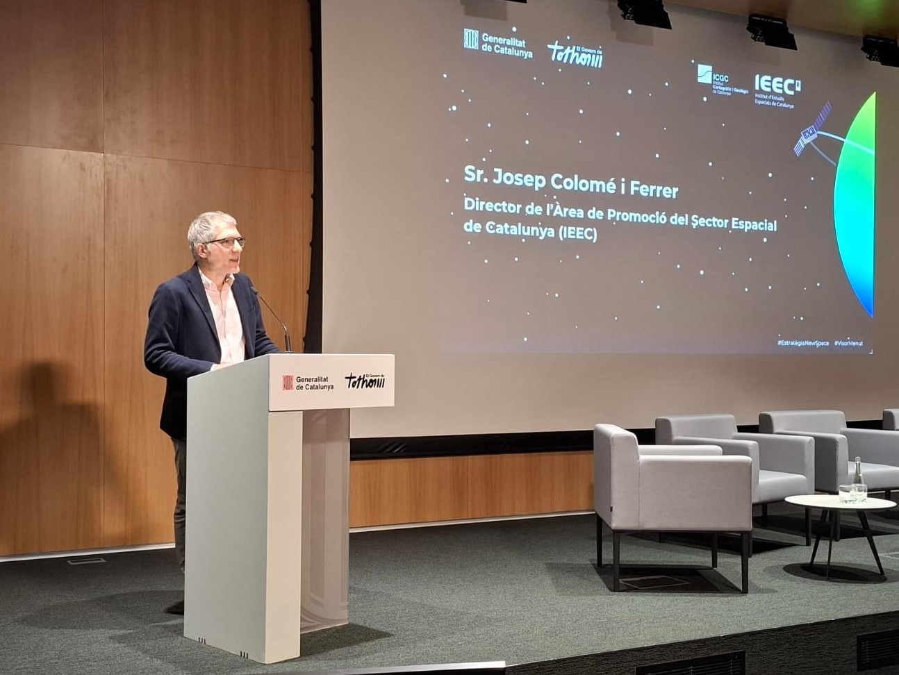
This was announced today by Maria Galindo, the Secretary for Digital Policies at the Department of Business and Labour, during an event aimed at the Catalan space ecosystem held at the Administrative District of the Government of Catalonia. The event also featured the participation of Antonio Magariños, the director of the Cartographic and Geological Institute of Catalonia (ICGC), and Josep Colomé, the director of the Area for the Promotion of the Space Sector at the Institute of Space Studies of Catalonia (IEEC — Institut d’Estudis Espacials de Catalunya).
In her speech, Secretary Galindo highlighted the importance of making this interactive tool available to everyone because “it facilitates the development of innovative applications based on satellite data, in this case, images from Menut, to respond to both the challenges posed by the climate emergency and those from various productive sectors and businesses, which can enhance their competitiveness by incorporating the use of these images in their operations.” She added, “With this new public service, we are taking another step forward in promoting, through the NewSpace Strategy, the entire value chain of the sector: we do not just want to be users of satellite data but to innovate in the field to excel in land management and its resources, and become more sustainable and resilient in the face of climate change.” In this regard, the Secretary for Digital Policies stressed “the implementation of use cases and proof-of-concepts where we are already seeing the results of these innovative solutions addressing the real challenges and needs of different productive sectors.”
For his part, director Magariños wanted to highlight that “the Menut Viewer is the result of 42 years of experience by the ICGC in Earth observation.” In this regard, Magariños stated that “its design and simplicity ensure that not only experts in the sector can work with the images captured by the nanosatellite, but it also opens the door for all sectors that can benefit from it to have a useful tool to begin working effectively, offering functionalities for discovery, visualisation, comparison, downloading, and basic analysis.” Additionally, the ICGC director added, “We have ensured the compatibility and complementarity of the Menut images with those from Sentinel to maximise the availability of information when needed.”
Regarding Menut, the director of the APEC at the IEEC, Josep Colomé, stated that “it is a platform for innovation in acquiring information through data collection from space, for innovation in the services and applications resulting from its exploitation, and for innovation in new technologies for satellite missions.” In this context, Colomé added that “a mission like Menut allows us to accelerate innovation in obtaining territorial information using new onboard technologies and new mission models that complement European programmes like Copernicus, of the European Union. The exploitation of this information generates new and better services designed to create new industrial markets and an economic boost based on the new space economy.“
About the Menut Viewer
The Menut Viewer is an interactive tool developed by the ICGC as part of the NewSpace Strategy, with partial funding from the Nuclear Transition Fund (FTN). It allows users to access and download processed images from the first Earth Observation satellite mission of Catalonia’s NewSpace Strategy, Menut.
Launched by the Government of Catalonia through the Secretary for Digital Policies of the Department of Business and Labour and managed by the IEEC with technical support from the ICGC, the Menut mission was awarded to Open Cosmos, the company responsible for its design, manufacturing, and operation. The Menut was launched two years ago, and since then, the ICGC has been working closely with the IEEC and Open Cosmos to ensure the regular provision of images with the established quality criteria.
“A mission like Menut allows us to accelerate innovation in obtaining territorial information using new onboard technologies and new mission models that complement European programmes like Copernicus, of the European Union. The exploitation of this information generates new and better services designed to create new industrial markets and an economic boost based on the new space economy,”
has explained Colomé.
The Menut nanosatellite orbits approximately 500 km from Earth at a speed of around 8 km/s and passes over Catalonia about every 5 days. Equipped with a state-of-the-art camera that captures images from space in different spectral bands, Menut can record images with a resolution of up to 5 metres of any location on Earth. However, it prioritises capturing images of Catalonia, which, after being analysed and processed, allow for territorial monitoring.
On the viewer released today, users can find images of Catalonia provided by the Menut nanosatellite with different processing levels, offering various possibilities in 6 main areas:
- Outreach: These images can generate content, news, and illustrations to promote the features, possibilities, and usefulness of this type of data.
- Training: They allow the creation of educational content to explain the main techniques and methodologies of Earth Observation and to develop teaching and training materials for analysing and processing this data.
- Interpretation: They offer the possibility of sufficient visual or digital analysis to determine or delimit landscape elements and identify objects or cover types.
- Spectral response analysis: These images allow for the analysis and differentiation of various cover types and the creation of spectral indices that help in understanding the territory and its condition.
- Biophysical variable determination: These images enable the extraction of values for biophysical variables using information gathered from spectral bands. The obtained information can later be validated with field data to establish segmentation of these variable values.
- Detection of temporal changes: Using data sets taken at different times, changes in the territory can be analysed, both geometric (such as the shape or texture of elements studied) and radiometric.
In addition to Menut’s images of Catalonia, the viewer includes images of Catalonia from Sentinel-2, a mission within the European Union’s Copernicus programme, which are also accessible and downloadable by everyone.
Access the Menut Viewer and find more information about its operation and features through this link.
Advantages of Menut images in use cases
The characteristics of the processed Menut images can provide added value for the development of applications using satellite images, as demonstrated by a first comparison to highlight this advantage in the two winning projects from the first edition of the ‘Earth Observation Use Case Ideas Competition for the Private Sector,’ coordinated by the IEEC as part of the NewSpace Strategy of Catalonia:
- MARE (Drought Monitoring with High Spatial Resolution): A product that offers soil moisture and drought index at high spatial and temporal resolution, using data from previous sensors. It provides a comprehensive view of drought conditions and the water requirements of crops through a methodology that uses satellite data.
- MOT (Earth Observation Module for PixelSuite): An integrated application for agricultural professionals working with woody crops, based on satellite spectral information. It automates the monitoring of field conditions through the analysis of spectral data from satellites, combined with field data using AI algorithms.
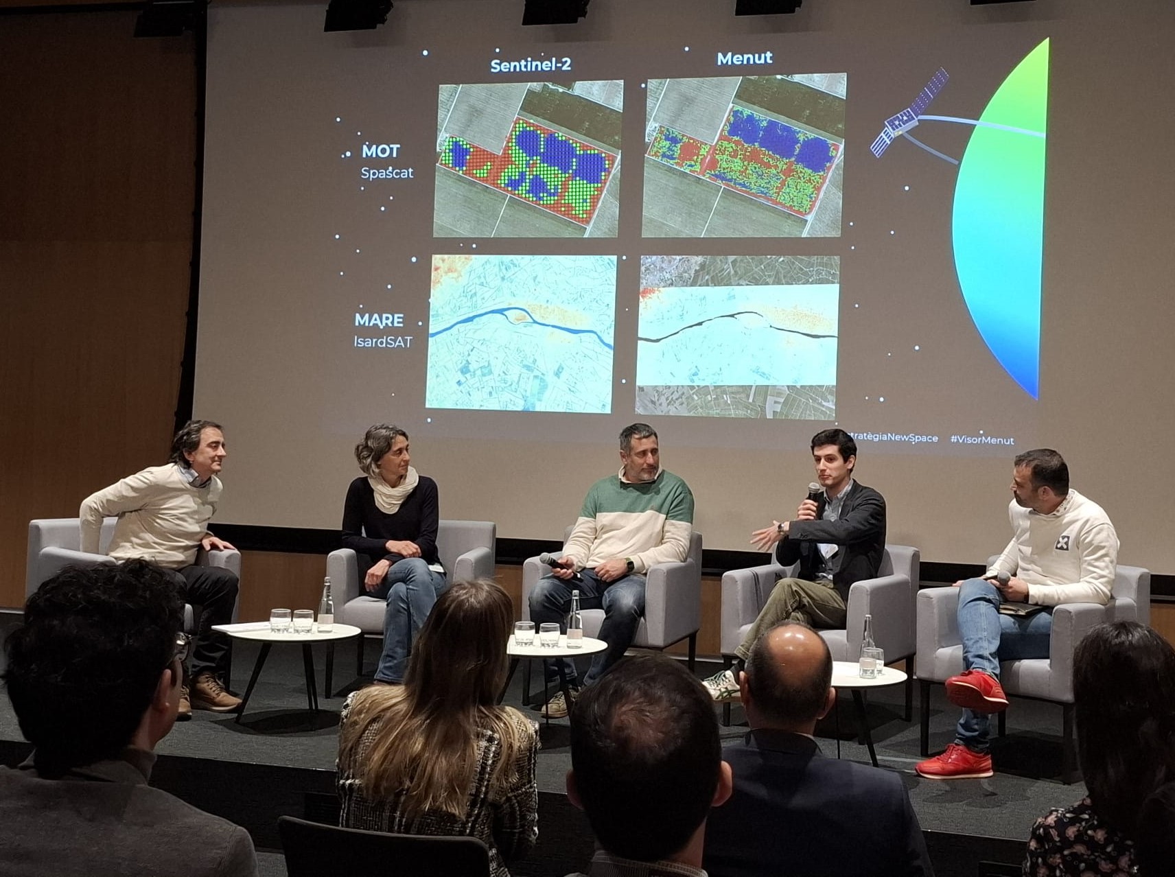
To explain these advantages, today’s event included a roundtable discussion in which representatives from the companies that developed these use cases —IsardSAT and Aigües Segarra-Garrigues for the MARE project, and Spascat and Raimat for the MOT project—shared their experiences as both providers and users. They discussed the added value that satellite images, specifically those from the Menut, have brought to the development of their projects.
Contacts
IEEC Communication Office
Castelldefels, Barcelona
E-mail: comunicacio@ieec.cat
About the IEEC
The Institute of Space Studies of Catalonia (IEEC — Institut d’Estudis Espacials de Catalunya) promotes and coordinates space research and technology development in Catalonia for the benefit of society. IEEC fosters collaborations both locally and worldwide and is an efficient agent of knowledge, innovation and technology transfer. As a result of more than 25 years of high-quality research, done in collaboration with major international organisations, IEEC ranks among the best international research centres, focusing on areas such as: astrophysics, cosmology, planetary science, and Earth Observation. IEEC’s engineering division develops instrumentation for ground- and space-based projects, and has extensive experience in working with private or public organisations from the aerospace and other innovation sectors.
The IEEC is a non-profit public sector foundation that was established in February 1996. It has a Board of Trustees composed of the Generalitat de Catalunya, Universitat de Barcelona (UB), Universitat Autònoma de Barcelona (UAB), Universitat Politècnica de Catalunya · BarcelonaTech (UPC), and the Spanish Research Council (CSIC). The IEEC is also a CERCA centre.